Bridge over Ho-yo strait
Javascript is required to view this map. Geographical location
ERA 2000 - Bridge over Ho-yo strait
|
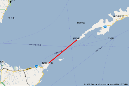 Top view of the location
ERA 2000 - Bridge over Ho-yo strait
|
|
This Project will allow direct communication between Kyushu and Shikoku, the southernmost islands in the four largest that form the Japanese archipelago. The Sada-misaki peninsula in Shikoku is 15 Km away from Sekizaki in Kyushu through the Hoyo strait. Although there is an intermediate uninhabited island, its characteristic of protected natural environment and the depth of its eastern coast do not allow us to use it as an intermediate support of the viaduct. This forced the project to be straightest between the cape Sada and Sekizaki. Two alternatives are considered, and both of them with the first bridge of 2000 meter span to cover 4000 meter until reaching a rocky island, which is used to put a foundation. The first plan consists of other 2 suspension bridges with 2000m and 2800 m span with their towers foundation reaching up to 150 meter depth. This last point involves in the second alternative adding the suspension bridge of double main span length of 3000 meters each. This solution reduces the maximum tower foundation depth to 100 meters. |
|
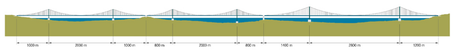 Side view - option I
ERA 2000 - Bridge over Ho-yo strait
|
|
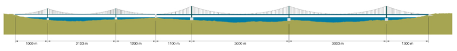 Side view - option II
ERA 2000 - Bridge over Ho-yo strait
|
|