Bridge over the mouth of Ise bay
Javascript is required to view this map. Geographical location
ERA 2000 - Bridge over the mouth of Ise bay
|
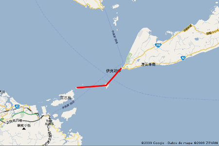 Top view of the location
ERA 2000 - Bridge over the mouth of Ise bay
|
|
Nagoya, the major city in Tokai area, is located at the bottom of Ise bay. At the bay entrance, the distance between Toba city on the west coast and the cape Irako on the east coast is approximately 20Km. However, two relatively large islands near Toba and other smaller, Kami, in the central area, all of them inhabited, may divide the trajectory in several structures. Irako channel, between the cape of the same name and Kami island, has the maximum depth of 100 meters and it will be used as the main navigation channel. It is proposed to get across this channel with a suspension bridge of three spans with its main span of 2100 meters. There are two alternatives for the west side exit toward Kami, one by north and the other by south. The north alternative involves in a route with significant water depth. Therefore they consider constructing a suspension bridge of four spans with its two main spans of 1400 meters in order to reduce the number of foundations in deep water. The maximum water depth at the foundation reaches to almost 60 meters. |
|
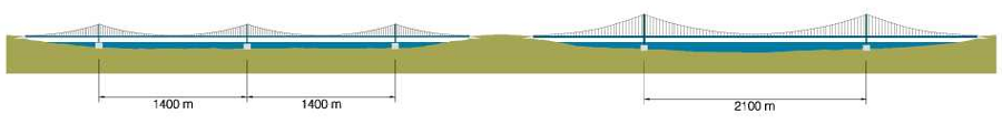 Side view
ERA 2000 - Bridge over the mouth of Ise bay
|
|